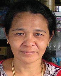
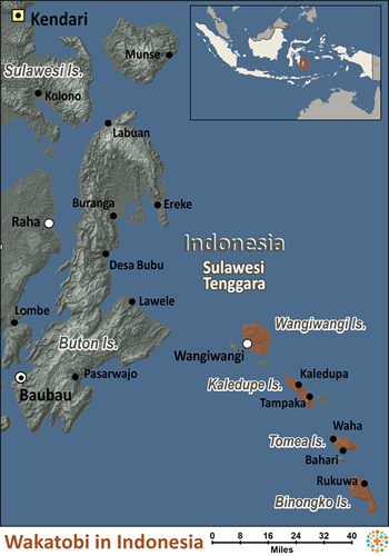
The island people formerly known as Tukang Besi (iron worker) in Southeast Sulawesi is now more commonly referred to as Wakatobi, which is an acronym from the four islands they live on: Wangi Wangi, Kaledupa, Tomia and Binongko, in the Wakatobi District. They consist of nine indigenous communities: Wanci, Mandati, Liya, Kapota, Kaledupa, Waha, Tongano, Timu dan Mbeda-beda. Each island has its own dialect, but people from different islands can understand each other when communicating.
The Wakatobi base much of their livelihood on agriculture. The main crops are corn, rice and cassava. Many Wakatobi are fishermen or boat builders. However, since economic opportunities are lacking, many sail to other locations in search of work, only to remain in their new areas. The Wakatobi people have scattered throughout much of eastern Indonesia. Seafaring is considered man's work, along with ironworking, boat building, brass and silver manufacturing and tending to crops in the field. Pottery, weaving, preparing meals, cleaning and managing the family's money are the women's primary jobs. Wakatobi houses are raised above ground and built of sturdy planks. The roofs are made of small planks, palm leaves or iron and the houses have only a few small windows.
Most villages have markets where woven silk, cotton and other fabrics are traded. The island of Kaledupa is well known for its soft fabric known as masres. In general, Wangi-Wangi is the most developed and is the seat of district government. It is also the transportation hub because of its proximity to Buton and Kendari. There is also an old fortress near the capital city with a community living inside it, similar to the one found in Baubau on Buton island.
The roads on Kaledupa are much less developed and there are several Bajau communities offshore. The islands of Hoga and Runduma on the east side of Kaledupa have some inhabitants and are great spots to see marine wildlife. Tomea is probably the second most developed island after Wangi-Wangi and has benefited from a nearby dive resort. Binongko is the most remote and least developed island, but is actually the home of the only iron workers still found in the island chain. The people of Binongko have many mystical stories about the origin of the island and sacred places that can be found there. Binongko's eastern half is home to Cia-Cia people.
The Wakatobi are Muslim, but they still believe in various kinds of supernatural forces. Ancestral spirits are considered to help in some instances and bring bad luck (such as illness) in others. The Wakatobi people also have a high regard for nature because it is God's creation. Sufi Islamic mysticism abounds with its focus on knowing God.
The Wakatobi need assistance in improving their physical infrastructure in areas such as electricity and clean water supplies. They also need training in appropriate technology and better formal education. They also need more medical clinics and medical personnel. The rising tourist industry has great potential because of the exquisite marine life in this area.
Pray for the Southern Wakatobi people to experience and respond to God's glory.
Pray for loving and committed workers to go to the Southern Wakatobi people.
Pray for Southern Wakatobi disciples who will make more disciples among their family members.
Scripture Prayers for the Wakatobi in Indonesia.
IPN, 2011 Copyrighted © Used with permission
| Profile Source: Joshua Project |


