Kutu in Tanzania
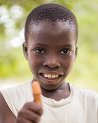
Photo Source:
Rasheedhrasheed - Wikimedia
Creative Commons
|
Send Joshua Project a map of this people group.
|
| People Name: | Kutu |
| Country: | Tanzania |
| 10/40 Window: | No |
| Population: | 152,000 |
| World Population: | 152,000 |
| Primary Language: | Kutu |
| Primary Religion: | Islam |
| Christian Adherents: | 3.09 % |
| Evangelicals: | 2.09 % |
| Scripture: | New Testament |
| Ministry Resources: | Yes |
| Jesus Film: | Yes |
| Audio Recordings: | Yes |
| People Cluster: | Bantu, East-Coastal |
| Affinity Bloc: | Sub-Saharan Peoples |
| Progress Level: |
|
Introduction / History
The Kutu live south of Morogoro in the Mbeta River Buffer Zone on foothills of the Uluguru Mountains of Tanzania.
What Are Their Lives Like?
Rice, maize (corn) and sorghum are the main crops of this area. Coconut and banana trees are a cash crop. Cotton was a main crop until 1989. They are beginning to grow sesame seeds as well.
The roads in this area are scheduled for a major upgrade and this should facilitate the flow of market goods and tourists coming to the north entrance of the Selous Game Reserve at Kisaki. Dakawa is one major Kutu community. There are a few primary schools in the area, and most Kutu villages have a Koranic school and a mosque. Some of their public schools teach German. Communities of the area seem to be multilingual. Some hypothesize that the availability of Scriptures in this language would help to solidify the culture.
The Kutu trace their ancestry matrilineally through the sister's line. Women could play a key role in reaching this group and leading in literacy and community development projects.
What Are Their Beliefs?
The Kutu people are Sunni Muslims who believe that the supreme God, Allah, spoke through his prophet, Mohammed, and taught mankind how to live a righteous life through the Koran and the Hadith. To live a righteous life, you must utter the Shahada (a statement of faith), pray five times a day facing Mecca, fast from sunup to sundown during the month of Ramadan, give alms to the poor, and make a pilgrimage to Mecca if you have the means. Muslims are prohibited from drinking alcohol, eating pork, gambling, stealing, slandering and making idols. They gather for corporate prayer on Friday afternoons at a mosque, their place of worship. Sunni religious practices are staid and simple. They believe that Allah has pre-determined our fates; they minimize free will.
The Kutu people also depend on the spirit world for their daily needs since they regard Allah as too distant. Allah may determine their eternal salvation, but the spirits determine how well we live in our daily lives. For that reason, they must appease the spirits. They often use charms and amulets to help them with spiritual forces.
What Are Their Needs?
The Kutu people have many health needs. AIDs is a problem throughout East Africa as is malaria. Christ followers can help them by establishing medical clinics.
Prayer Points
Pray for loving workers who will not stop until there is are Kutu disciples making more disciples.
Pray for the Lord to give dreams and visions of Christ to Kutu elders and family leaders.